From us on foot to Městské skály
Hotel Perk - Sanatorka Monument - Angel Trail - Former Quarry - Městské skály Lookout - Hotel Perk
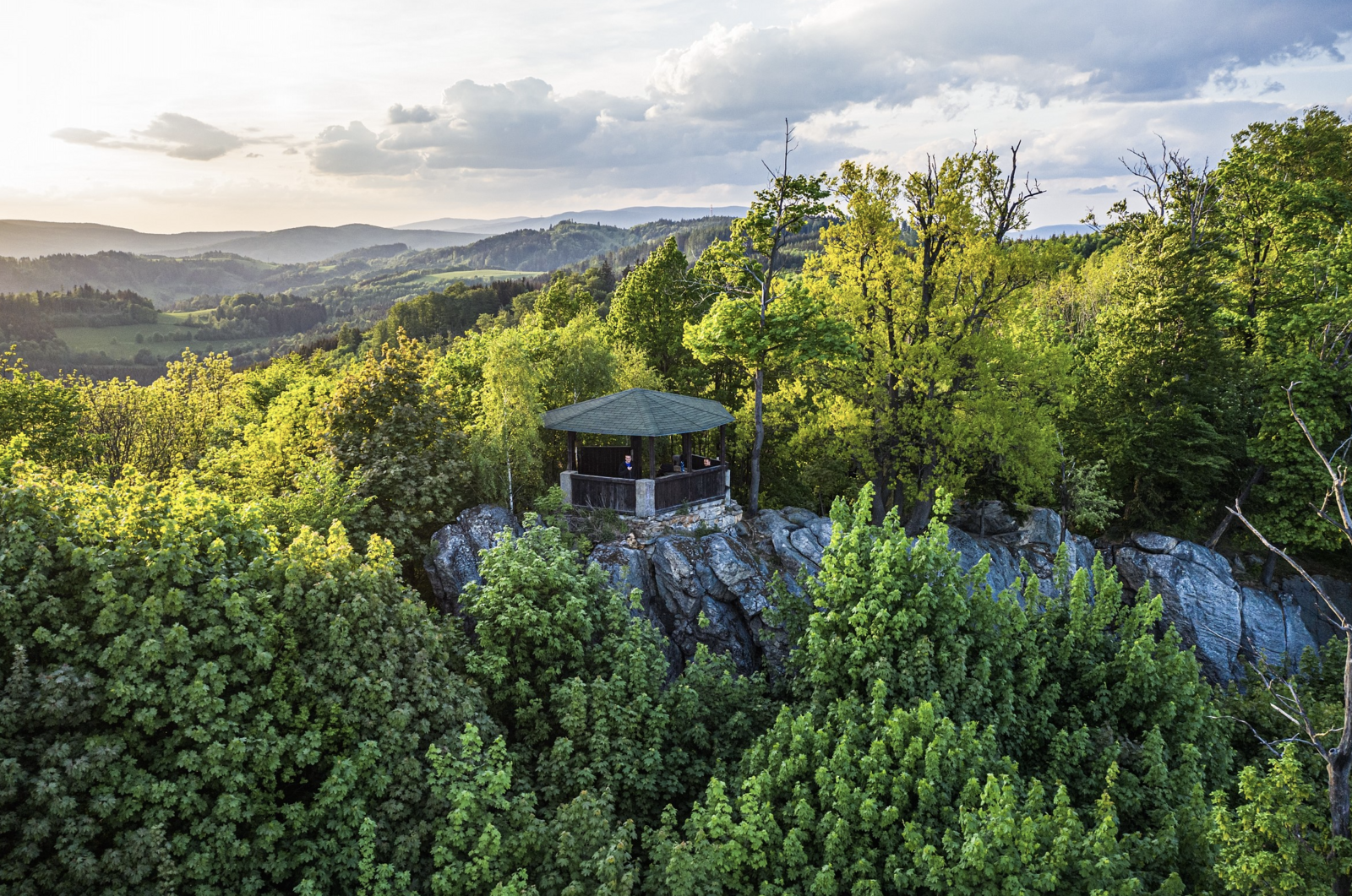
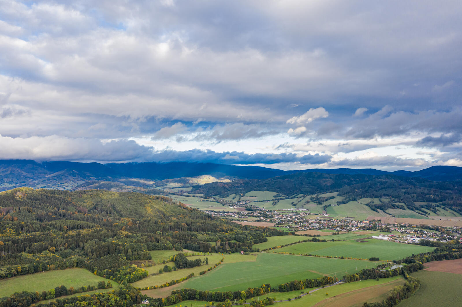
This area is particularly sought after as a climbing terrain, but Městské skály will also delight those who, instead of climbing, would rather take a walk ending in a wonderful view of the landscape with the possibility of resting in a covered gazebo. The place is accessible by following the green sign from Šumperk. Městské skály are located at an altitude of 675 meters. The rock formation extending into the region is part of the Hanušovská Highlands in the northern surroundings of Šumperk.
ROUTE DESCRIPTION
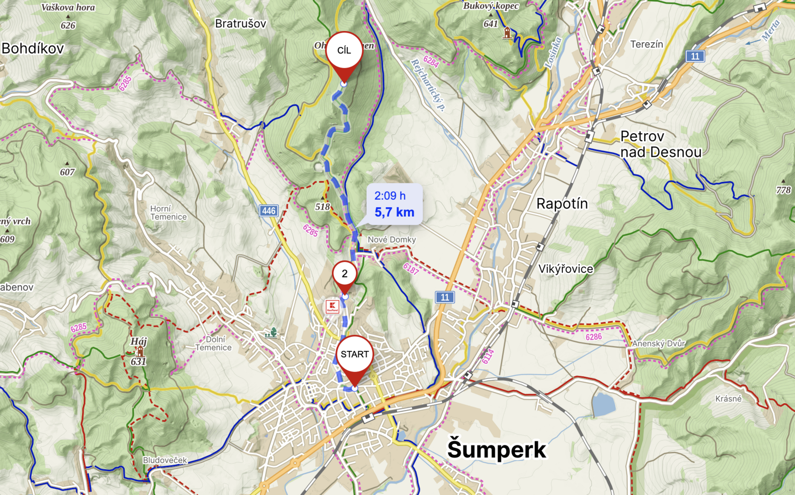
Městské skály can be reached on foot directly from the hotel. If you choose to do so, head towards the "Monument of the Sanatorka", which is considered the starting point of this route. Slowly you will find yourself out of the built-up part of the town on the forest path of the "enchanted forest", through which you will be guided by fairy-tale statues. You will also find several wells with seating. Just before the Tulinka signpost, a children's forest playground with a small rope centre, a robber's house and an anthill peeps out at you in the shade of the trees. At the Tulinka signpost, you will join the green hiking trail and follow it to Městské skály. After about less than a kilometre you will also discover a small unique building. The dilapidated transformer station, which used to supply the now disused town quarry with electricity, has received not only a much-needed renovation, but also an unexpected decoration - statues of angelic beings. A pleasant seating area has also been built here and children can spend a short while at an educational panel about bark beetles. A few dozen metres from the substation, you can turn onto an inconspicuous path leading to the quarry and take a look at the places where rula used to be mined. When you get back on the green hiking trail, you will slowly start to notice the meters you have climbed. At this point, you will have a kilometer to go to prepare for the final climb, which will test your fitness not only with the quickly gained vertical meters, but also by climbing over fallen trees. This section is no longer passable for strollers.
If you are discouraged by the view up the steep hill, the alternative is to continue along the unmarked path to the signpost Nad skálami and then take the green path. This will spread the 115 metres of ascent that you would have climbed in just over 500 metres by the shorter route over 2.5 kilometres.
DISTANCE
11 km (there and back)
DURATION
in 4 hours (there and back)
DIFFICULTY
medium
SUITABLE FOR CHILDREN
yes
SUITABLE FOR STROLLERS
only part of the route is passable with an all-terrain stroller (forest path)
GPS COORDINATES
50.0075236N, 16.9777942E